Wairoa River Bridge
Wairoa River Bridge
Clevedon Wharf Reserve, 48 Clevedon-Kawakawa Road
Trail Marker Location #10
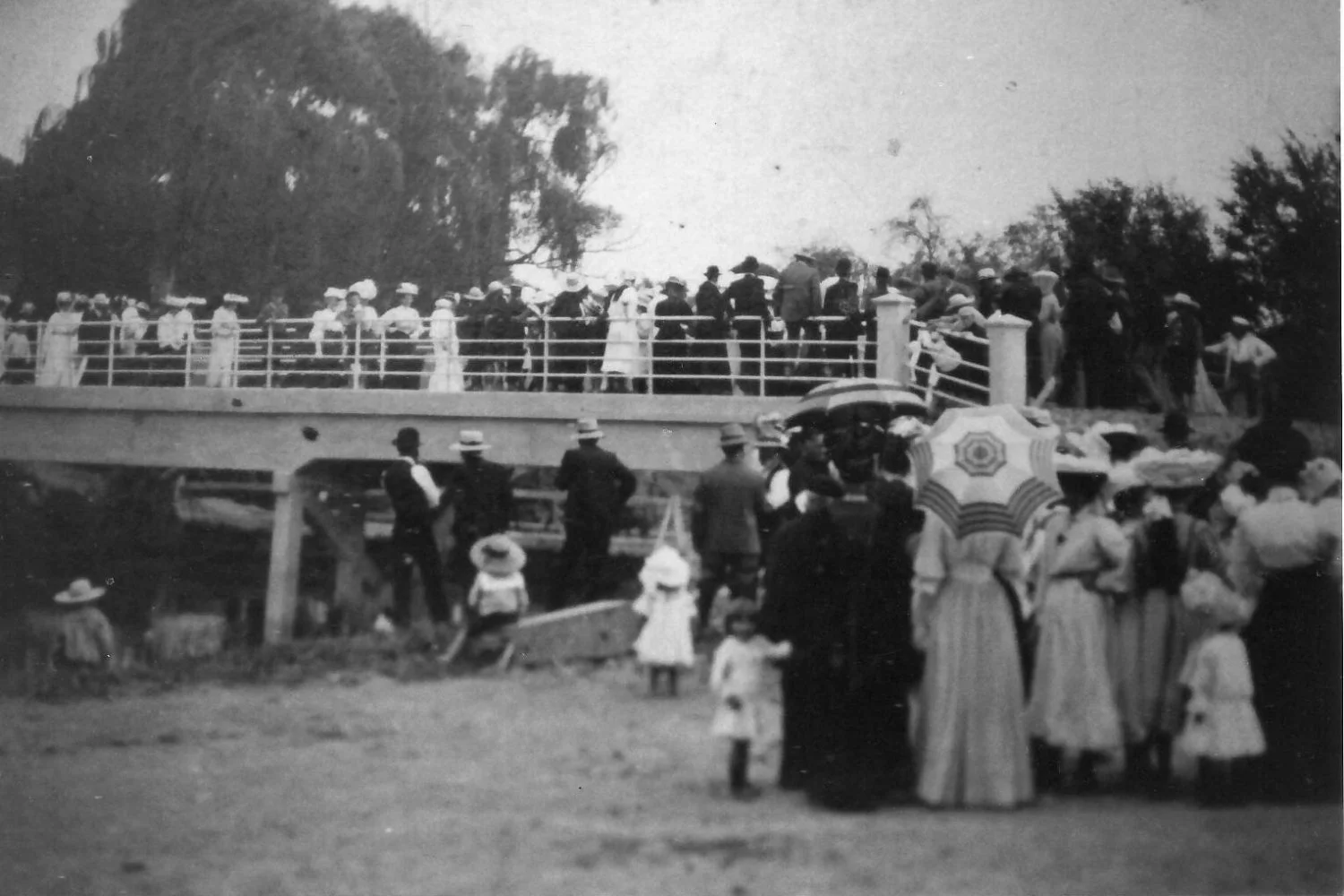
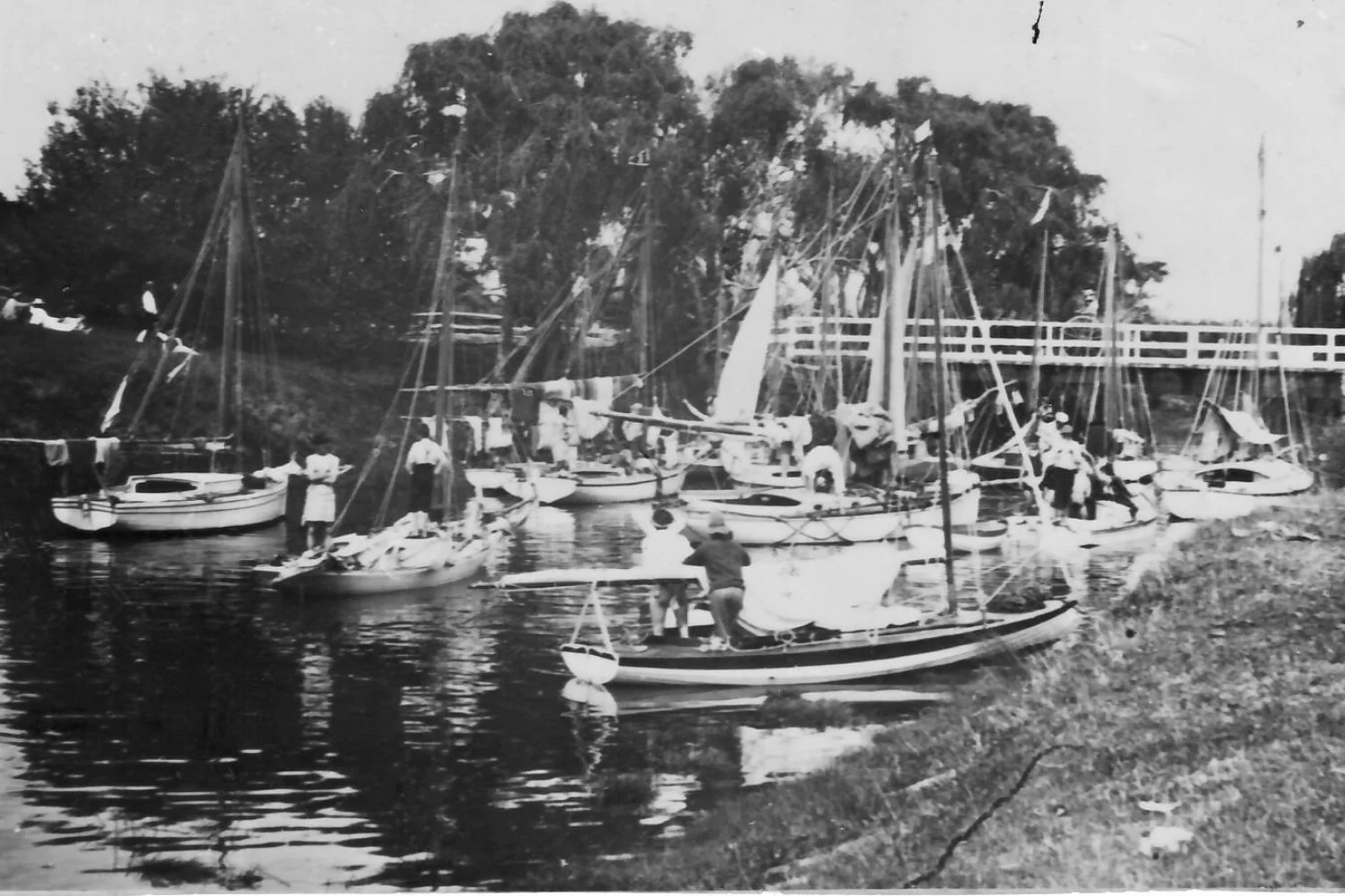
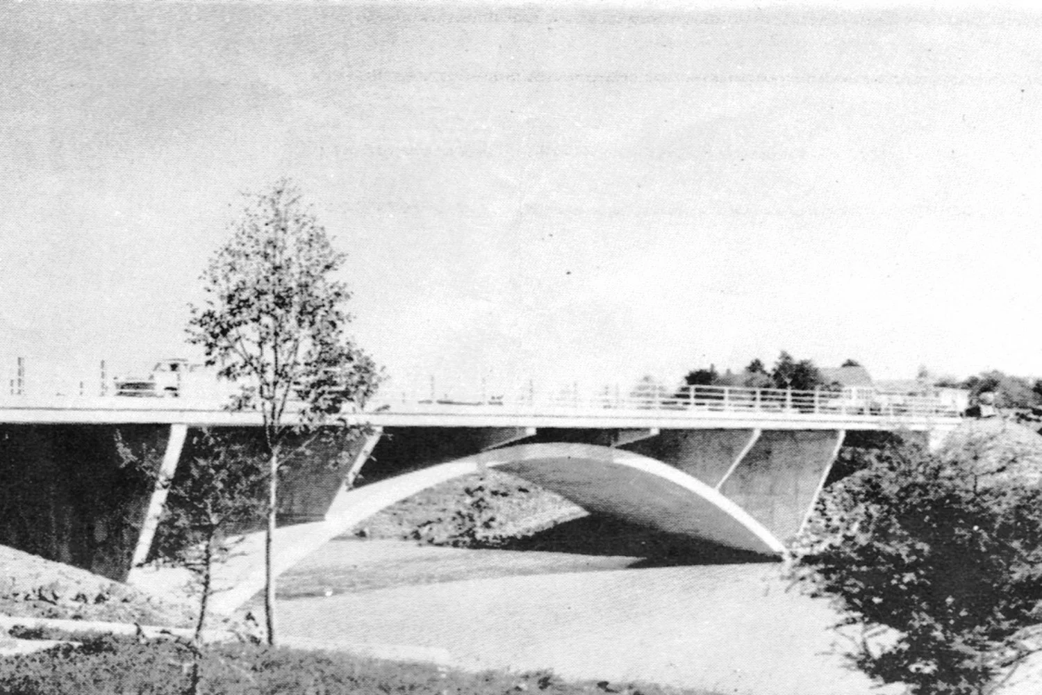
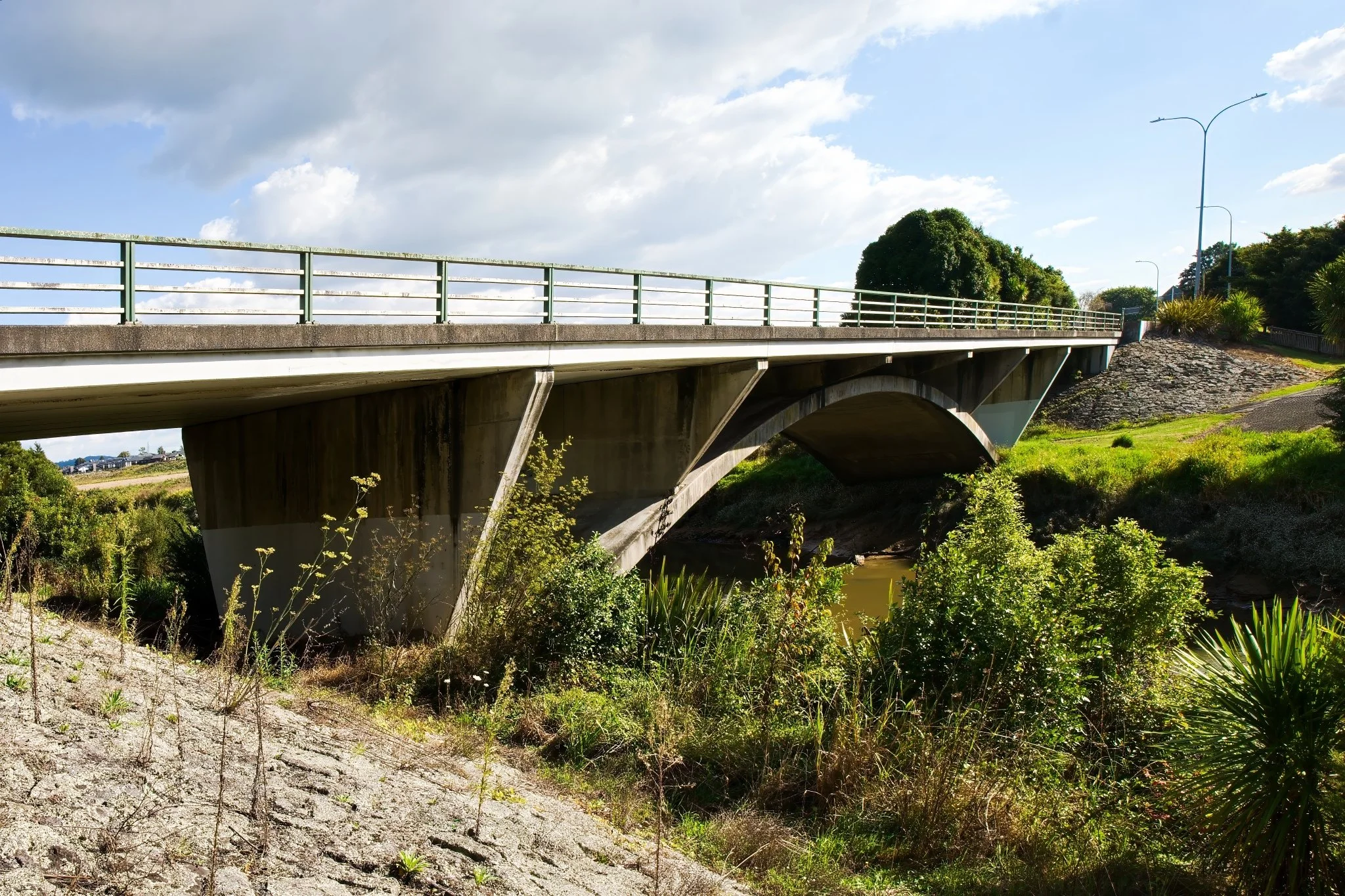
Four bridges have spanned the Wairoa River in this position since c 1863.
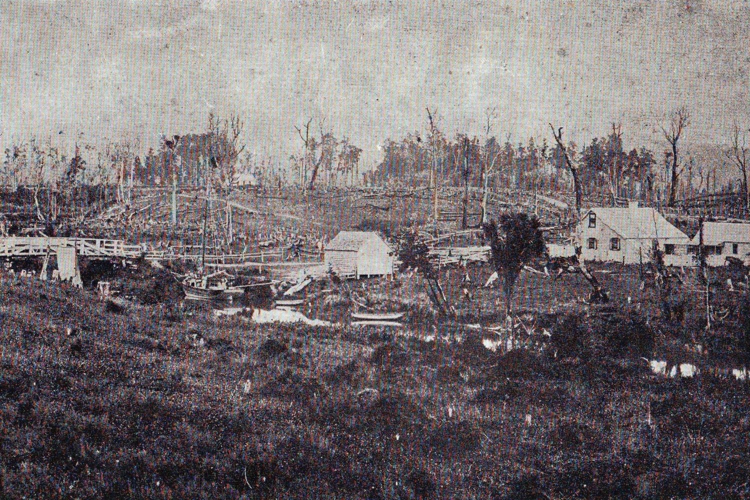
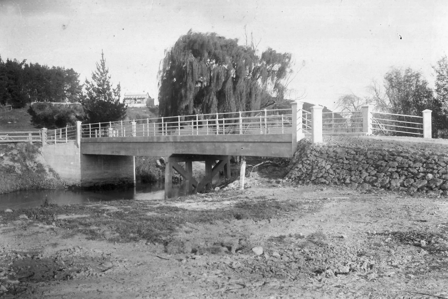
Prior to the building of the first bridge, shingle crossings upstream and beyond tidal influence were used. The first bridge was a wooden truss design. It fell into disrepair, and in 1880-81 was replaced by the second bridge, which was washed away by a flood in 1907. It was found downstream and towed back to a temporary position until replaced by a one lane concrete structure in 1908. This was one of the first reinforced concrete bridges built in NZ.
Motor traffic was not common in 1907, so the new bridge was more suited to horses, pedestrians and occasional bullock teams. Loading stresses on the bridge, caused by motor vehicles, resulted in a major rethink of the design. It was eventually replaced by the present bridge which was opened in July 1966.


Location Map
You are currently at Heritage Trail Location #10, Wairoa River Bridge
Ready to see the next site? Follow the path highlighted in orange (or the directions below) to reach your next location:
Settlers’ Cairn (approx 175m)
-
Next site:
Settlers’ Cairn (approx 175m)Return to the Clevedon-Kawakawa Road via the stairs. Turn left and cross the Wairoa River bridge. Approx 25m on your left is access down to the cairn, which is visible from the road.

The information for each site has been thoughtfully prepared in collaboration with the Clevedon Districts Historical Society, drawing on Voices of Belonging by Jessie Munro, Yesteryears by F. Murray, and records from the McNicol Homestead Museum. Together, they tell the story of Clevedon and the people and places that made it the community we know today.
A special acknowledgement to photographer Donna Jepsen for her work capturing these sites as they appear today.
-
“Voices of Belonging”, Jessie Munro, 2016. Available to view and purchase at McNicol Homestead and for loan from the Clevedon Rural Library.
“Yesteryears”, Fraser Murray, 2009. Available to view and purchase at McNicol Homestead.
The Archeology of Clevedon Village and Wairoa River Valley, Opus.
The History of Clevedon School
An broad overview of our local history is available at clevedon.co.nz
Ngai Tai ki Tamaki’s history is rich and detailed in a number of online records;
• Ngāi Tai ki Tāmaki website (“Our Stories”)
• Ngāi Tai ki Tāmaki’s Deed of Settlement (Section 2.0 Historical Account)
• Clevedon School 150 year anniversary summary